Finding the Right Spots to Build
Hello and welcome back to the sixth part of my series Beyond the Image, where I share the story behind the house featured in Super Finnish’s marketing. In this series, I take you through the inspiration, the five and a half months of building, and where the house stands today. In this post, I’ll talk about the importance of the ground survey and how it guided me in deciding where to position the buildings on the land.
I hope you enjoy it!
Beyond the Image: Part 6
Having the building designs ready was a crucial step for what came next. The architectural drawings gave me the exact dimensions of the buildings, which allowed me to start measuring and visualizing them in my dream locations on the land. To move forward, I needed to have a ground survey done. A necessary step not only for planning but also for the permit process.
A Man and a Shovel
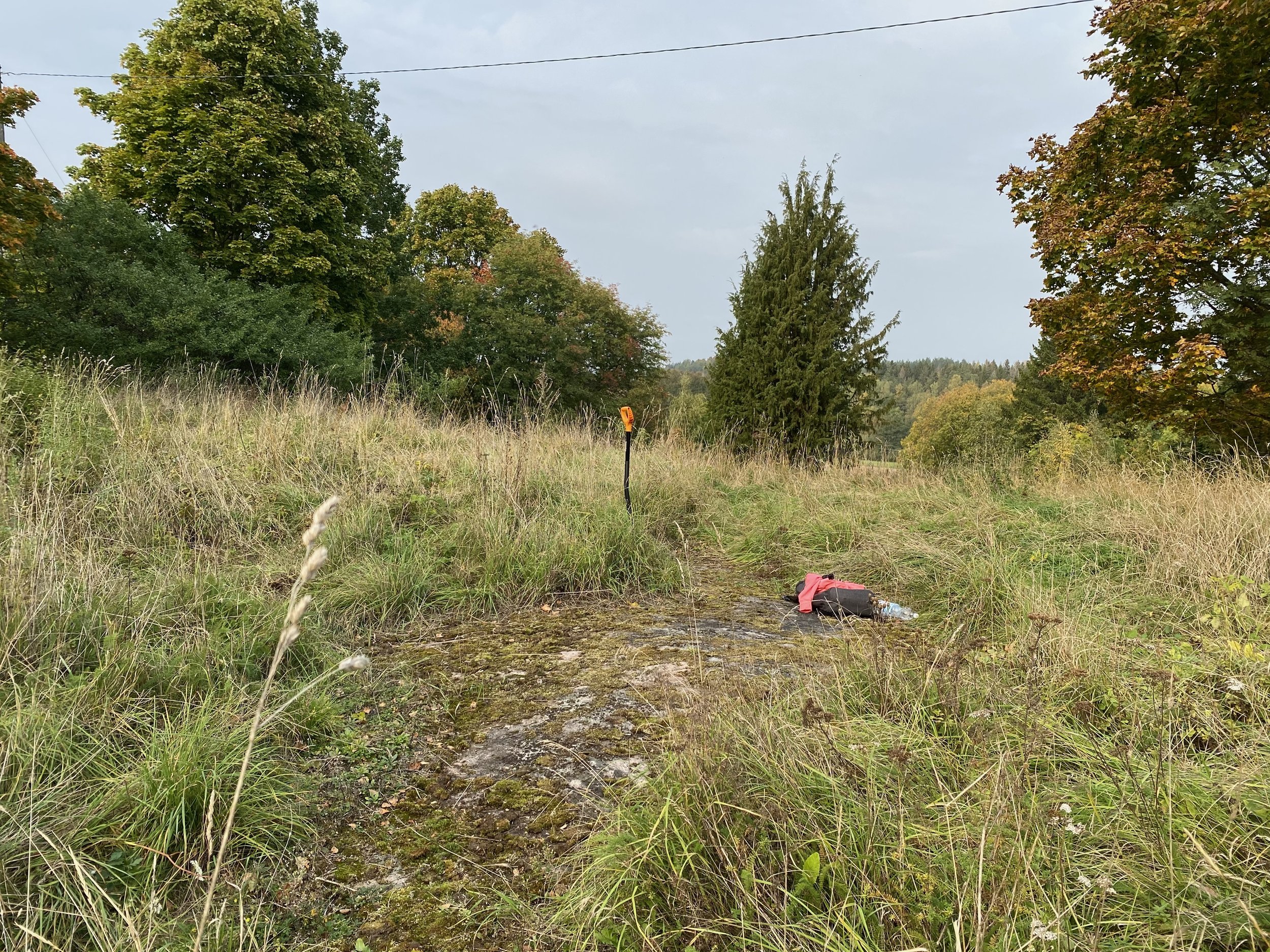
As I’ve mentioned before, patience isn’t exactly my strong suit. I ordered the ground survey, but instead of waiting for the company to come and take care of it, I decided to do my own version first. I called this part “A Man and a Shovel.” I drove to a nearby hardware store, bought myself a shovel, and headed to the property - it was about time to get my first tools anyway. I started digging holes around the land to check how close the bedrock was to the surface. Some parts of the land had exposed bedrock, which gave me great ideas for where to locate the buildings.
Bedrock is the best possible base for a foundation! It’s sturdy and won’t shift over time. In Finland, temperature changes can cause significant ground movement. When the ground freezes, the soft material shifts, and by spring, nothing is in the same place. Preventing this requires a lot of insulation and preparation. That’s why finding exposed bedrock was such great news - it’s reliable and won’t move, no matter how much the weather changes.
The “A Man and a Shovel” ground survey in full action. Fun fact: the bedrock you see in this picture now sits directly beneath the kitchen island of the house.
By this point, I had a pretty good idea of where I wanted to build on the land. I used my shovel technique to check if there was a lot of soil or other material that would need to be dug away. While it wouldn’t have been a problem, ground preparation can get very expensive. As you probably already know, I did everything I could to save money, so I wanted to finalize the building locations based on my prediction of the ground preparation costs. The great news was that my one-man survey gave me a solid understanding that I wouldn’t have to deal with a lot of digging.
What the Ground Survey Revealed Beneath the Surface
The next day, the actual ground survey took place. The company brought a remote-controlled drill to the land, which they used to drill holes until they hit the bedrock. They also measured the height variations across the land, which was another crucial factor to consider when building a house.
In Finland, it’s essential to ensure you don’t build your house in a low spot. The home needs to be well protected from water, such as melting snow or rain. This meant that the house either had to be placed on the highest point of the land, or the ground preparation had to be done in such a way that the sides of the house were sloped to direct water away.
While my technique was effective, the actual ground survey provided the definitive answers.
The ground survey company spent about an hour on the lot and brought me some great news. The ground preparation shouldn’t be too expensive, as the bedrock is fairly close to the surface everywhere. With this information, I was able to finalize my decisions on where to place the building, allowing me to move on to the next phase: hiring an architect to create a zoning plan.
Ground Survey Report
The final report from the ground survey showed the locations of the exposed bedrock and the height variations across the land.
Jussi-Pekka Kajaala
Nordic Visionary, Creative Entrepreneur


